Showing posts with label Winter Hikes Card Deck. Show all posts

Wednesday, January 06, 2010

The End of Winter!
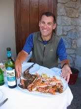
Well, not really, but its the end of real winter for me as I am now back home in the mild Pacific Northwest! The eastern half of the country is experiencing real winter with real cold and real snow and I really enjoyed it while I was back there! No matter how long I have been out here in the Pacific Northwest, winter to me means bitter cold winds-fire red sunsets-skeletal birches against a gray sky, ponds frozen solid that crack and echo in the silent January air-sitting around a wood stove sipping hot chocolate in a picturesque village that kept Revolutionary War soldiers and colonial farmers snug and warm. Winter in New England is special and if you don't like the snow and cold you best not think about relocating in New Hampshire and Vermont. But if you love snowshoeing and cross-country skiing across rolling hills and charming villages or skating Charlie Brown style around a small pond in a town common-northern New England your place in January. Now, back in the Pacific Northwest where the mercury dances at 50, I can once again don shorts and enjoy snow free hiking. And let me tell you about some of the best snow free winter hiking in America. Come attend one of my upcoming talks. Hate snow? No problem-the lowlands of Western Washington will spare you the blanketing white stuff!

(photo- Me at the NH Audubon Massabesic Center)

Thursday, November 05, 2009

Don't Hibernate This Winter!

The days are now short. The rains are now long. The hardwoods are almost barren. And the ground is fully saturated. The mountains are beginning to look a bit like winter. But whatever you do-do not-absolutely do not stop hiking! My latest release, Winter Hikes of Western Washington will give you 50 reasons not to store away your hiking boots in the next few months. Winter Hikes is a full color over-sized card deck (but still a guidebook-just a neat format here meant for you to take a card and go!) of 50 hikes that for the most part (last December exempted) remain snow free all winter long. Unlike many other parts of the country, Western Washington remains green-and fairly mild during the winter. You can easily hike here in December, January and February. And since many of your fellow hikers are busy putting on extra pounds sitting around the TV, you can hit some trails that may be quite popular during summer-but are quite quiet during winter. My 50 hikes selected include a wide array of destinations from lakes, to ocean shoreline, Puget Sound Islands, mountain tops, urban backyard wildernesses, and teeming with birds wildlife refuges. And the geographic range? All over Western Washington from the Columbia Gorge to the British Columbia Border. Cape Disappointment to the Middle Fork of the Snoqualmie River. Check them out and let me know what you think. See you on the trail this winter!
(Click on the Top photo to order. Click on the bottom photo to see the 5o hikes included in the deck)

Tuesday, August 11, 2009

Hitting the Trail this Winter?
It's in the Cards!

Who says that you have to hang up your hiking boots when the rains and snows of November come blowing in? I'll give you 50 good reasons (hikes) to keep hiking-and I'll lay out those 50 reasons (hikes) for you in attractive handy-dandy laminated cards perfect for popping into your pack. Check out my new Winter Hikes of Western Washington card deck. Fifty mostly snow free hikes from the Columbia River to the British Columbia border. Hikes in the Cascade foothills close to Seattle-hikes on the Long Beach, Olympic, and Kitsap Peninsulas-hikes in the Columbia Gorge, Puget Lowlands and San Juan Islands. Plus-after you retreat from the colds days of winter, I offer great suggestions on where to warm-up afterwards. You're sure to enjoy this card deck with 25% of the highlighted hikes not found in the Day Hiking guidebook series-and these cards make for the perfect Christmas gift-heck, perfect anytime gift! Check 'em out and I'll see you on the trail this winter. In the meanwhile, I now return you to summer!

Friday, May 01, 2009

Almost Paradise!

As far as I'm concerned, you can't have too many parks and trails. So, I'm absolutely ecstatic over the opening of Snohomish County Park's newest addition, the Paradise Valley Conservation Area. Protecting nearly 800 acres along the headwaters of Bear Creek on the King-Snohomish County Line, Paradise isn't exceptional so much in its landscapes as it is in its location. To have a parcel this large so close to the Seattle suburban sprawl is a major conservation win. Currently there are over 13 miles of trails traversing the property with more on the way. Paradise Valley makes for a good close-by get away and it'll make a great winter hiking option. While I didn't include it in my upcoming Winter Hikes of Western Washington Card Deck, I did include it in my upcoming Hiking Snohomish County Booklet. And of course you can learn more about this area through Hikeoftheweek.com where I'll be spotlighting trails from the park from time to time. Good job to all who were responsible for securing this property. Now, get to work securing some more lands before its paved over!

Sunday, February 15, 2009

Pearl of the Chuckanuts
How much is it worth ?
Heather and I spent Valentines Day yesterday cruising the trails of Blanchard Mountain, covering over 13 miles worth on what turned out to be a wonderful February day. From my home office window I have a straight shot view of Blanchard Mountain-often luring me to stop keyboarding and start thinking about hitting the trail. The trail system at Blanchard is excellent and it makes for a great backyard recreation area for Skagit and Whatcom County residents. We hiked in from the quiet Alger side-cruised to snow covered Lizard and Lily Lakes before taking in the spectacular San Juan Islands View from the Oyster Dome, the pearl of this mountain-to- sound-greenway. The whole area makes for a great winter hiking destination and you can find more information on the area in my Day Hiking North Cascades Book. The region is also highlighted in my upcoming Western Washington Winter Hikes Card Deck. Definitely come on over here if you haven't yet and are itching to stretch your legs in now in the heart-of-winter.
And while hiking these trails, I leave you with a couple of things to contemplate. The Pacific Northwest Trail which traverses Blanchard Mountain could possibly become a National Scenic Trail this week if Congress passes the Omnibus Public Lands Management Act of 2009 (See earlier posts). If this bill gets passed, there will be more funding and recognition for this this long distance trail which travels from the Olympic Coast to Glacier National Park in Montana. Much of the route currently utilizes roads and it would be great to get it all onto actual trail. A good portion traverses the Cascades foothills of Skagit County too offering quieter hiking alternatives than the Issaquah Alps. A Major trail upgrade would have many benefits.

And while we are talking about upgrading and up keeping trails, Washington State is facing a 7 billion dollar deficit and its looking like that will be having a heavy toll on our parks and public lands. Other than the state considering eliminating state parks, government officials are considering enacting a day use fee on DNR lands to help offset the drastic reduction in funding due to the hemorrhaging of the timber cut from those lands. While supporters and objectors for day-use fees on public lands will no doubt once again retrench into their familiar ideological arguments for or against-to me it looks like a nominal day-use fee is a necessary evil. I would rather purchase a $25 annual pass to recreate on Blanchard, Tiger, Si, Silver star, Loomis, Table and a host of other places than let my public lands become run-down and over run with methheads, vagrants, shooters and other dregs. A healthy society needs healthy public lands and easy access to them. Closing parks and forests or letting them run down and become havens for criminals is not a wise option. Swallow your objections to day-use fees and reach a little deeper into your wallets this year to help save our irreplaceable natural heritage. Contact our legislators and governor and demand that they not close or decrease access to our public lands. Then be sure to vote out the irresponsible reckless politicians (Democrats and Republicans) that got us into this financial mess. Now go take a hike and put all this on the back burner for a few hours!

(Photo- Its one shell of a view from the Oyster Dome- Feb 2009)

Sunday, December 07, 2008


Rebirth of a Valley
Last week I had the opportunity to hike the Middle Fork of the Snoqualmie River Trail. I had hiked the upper reaches of this valley back in 1991. Back when the valley was a dumping ground, shooting ground, and a refuge for fugitives and meth-heads. It wasn't a very nice place back then and a place you definitely did not feel safe in. Boy, have times changed-and for the better! The Middle Fork is transforming into what it should have been from the get-go a recreation and wild haven- Seattle's backyard wilderness- and a great place to hike, camp, explore and play. Much of this transformation has been the result of concerned citizens and in particular the vision of the Mountains to Sound Greenway. The greenway, a non-profit non-partisan organization made up of a wide array of members continues to transform this valley as well as the I-90 corridor from Seattle to Ellensburg into a top-notch wildlife and recreation gem. Bravo! Where once I thought I had seen enough to discourage any further hiking, I now look forward to returning. My two upcoming projects- Winter Hikes and Backpacking Washington both contain Middle Fork Destinations. I think people will be pleasantly surprised to find such a great area so close to the city. I look forward to more explorations here. But please upgrade the road! It is still a God-awful pothole ridden aggravating byway!
(photo- alpenglow on the Russian Buttes above the Middle Fork of the Snoqulamie River)

Friday, November 21, 2008

Ceder Butt?
And just what the hell is a Ceder Butt? Evidently its the geodetically recognized little landform rising just to the east of Rattlesnake Lake outside of North Bend Wa. Is ceder anything like cedar? And is a Cedar Butt anything like Ash Ass, Cherry Cheeks, Basswood Buns, Hemlock Hynee, or Beech Bum? I hope not! The thought of slivers in a very precarious place immediately come to mind!
But seriously- Ceder Butt? What were the hiring standards like for the government back in 1937 when that benchmark was set? Yeah, I know-probably not much different from today.
Ceder Butt is one of the 50 featured hikes in my upcoming Winter Hikes Card Deck to be released next fall by Mountaineers Books. You don't need to wait that long though to see this nice butt! Get yours in gear and enjoy the hike!