A Suiattle Sooner can't wait to hike the Suiattle any sooner!
Count me to be one of the Suiattle Sooners. That is, I plan to rush the magical Suiattle Valley as soon as the road is reopened which should be sometime late this summer. Finally! Access to the much of the Suiattle Valley and Whitechuck River Valleys was lost in 2003 when dev

astating floods claimed the Forest Service Roads leading through them. Lost was access to miles of some of the most magnificent hiking trails in the Northwest. And with loss of access, came loss of maintenance and a threat of permanent loss. Which was the case for the Whitechuck, the road washed out in so many places that not even the most stimulus happy Congress could ever justify or provide the funds to rebuilt it--not to mention new environmental concerns as well.
The Whitechuck Trail was a favorite for many and I will always cherish my Halloween 1999 hike on It to Kennedy Hot springs. They're gone too-reclaimed by the earth they once bubbled up from. Lake Byrne will still be accessible via Lost Ridge and the upper Whitechuck still accessible by the Pacific Crest Trail-now fixed and fortified as well. These destinations will be within the backpacking domain-and that's okay, leaving them for the more adventurous intent on a bigger payoff of solitude and true wilderness. But day hikers have plenty to rejoice about too, for Green Mountain, Sulphur Mountain, and Huckleberry Mountain will once again be within their sights.
Thank God-my Day Hiking North Cascades Books has been pitching them for years. And the most glorious spot of all in the Suiattle Valley, Image Lake and Miners Ridge will once again be hikeable from the west. I hiked this area from the east this past summer for my upcoming Backpacking Washington book and can conclude that Image Lake is truly one of the most spectacular places in all of Washington-make that the nation! Yeah, sure there will be a few more people there in 2012-but it's still a 16 mile slog from the west-one that only the hardiest and most determined backcountry trekkers will attain-and they deserve it! Bring on the Suiattle-I can hardly wait-hope to see you on the trail-I'll be there first thing on opening day, pack on and boots ready to kick up some tread!
(photo-Glacier Peak rising above the Suiattle River Valley from the Miners Ridge Lookout 08.10)
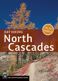 Trying to keep up with road closures and trail conditions can be downright daunting. And as much time (seems like always) as I am on the trail researching for my guidebooks, it can be a challenge keeping my books updated. I hike, map and research every trail I write about so you can trust my information when you hit the trail. But what happens when something changes after my book is published? We try to reprint each title every 12-18 months, so I can add those changes in. I also try to keep you informed on my blog, facebook site and website. But I also can use your help too. You see I am always out researching a new book which means my focus stays in one area for long periods of time. So if something is happening over on the Olympic Peninsula and I am spending the summer near Mount St Helens, I might miss that change. I try to keep up with all my sources to keep me informed, but many times in the field I am not getting that information. With that said, please don't hesitate to send me an email about anything you notice changed from the time of my books' printings. I just finished making revisions/corrections for the 3rd printing of Day Hiking North Cascades. I am currently researching two new books, Day Hiking San Juan and Gulf Island and Day Hiking Mount St Helens. I'll be working on a second edition on the Day Hiking Olympic Peninsula soon with all kinds of changes -including adding new hikes! Let me know if there is anything in particular you want to know more about. And please let me know if there have been any trail/road/land-use changes out there! Thanks and I look forward to hearing from--and thanks for all of your support!